Friday, October 28, 2011

Turtle Bay, Mexico

We arrived in Turtle Bay, Mexico on Oct 27th after 3 days at sea. We sailed about 325 miles with fair winds for two thirds of the trip. For two of the three nights at sea we had winds in excess of 20 knots. The last day at sea we stayed up for 24 hours and got so puchy that Cindy thought she saw a sea plane in the water next to our boat...it was just another sailboat.

Later that day after we anchored in Turtle Bay,  I found a dead flying fish on our decks...it was our first flying fish but it was dead too long to cook for breakfast (darn the bad luck).

Since we have very limited email I cannot post images until we arrive at Cabo San Lucas in about a week.

The crew of Cool Breez'n are enjoying warm weather and very friendly people in the village of Turtle Bay.

s/v Cool Breez'n

Saturday, October 22, 2011

Oceanside to San Diego, October 15, 2011

Readers can now leave comments on this blog.
Please no last names, no addresses, no phone numbers, no email addresses, no inappropriate language


We left Oceanside Harbor at 8:10 AM without breakfast, showers or stopping at the fuel dock. We topped off the tank from our jerry cans on deck. The weather was clear and the forecast favorable, light winds and patchy fog, temperatures in the high 60’s. We were anxious to get to San Diego to meet up with the rest of the Baja Ha Ha sailors and to find repair services to fix our outboard motor and auto pilot. We planned to stay in San Diego for 10-days, hopefully that would be long enough to complete our repairs and re-provision the boat.

The wind was light forcing us to motor the 40 nautical miles from Oceanside to San Diego. We motored through several pods of porpoise. Some porpoise came very close to the boat while others kept their distance. At one point the water was alive with 50 or more porpoise that leaped out of the water every few seconds. Some flew entirely out of the water, others broke the surface only long enough to catch a quick breath then submerge. In the midst of all these porpoise, a small whale with a white back surfaced not far away. It almost looked like the whale had snow on its black body. When the fog began to engulf us the porpoise vanished. I took a picture of Cindy bundled up in her fleece jacket and hood, it was not the picture we had in mind when we were dreaming about our trip from the comfort of our home in Woodinville. We thought temperatures would have been warmer this close to San Diego.

Cindy bundled up on a foggy day

The fog and clouds lifted a few miles away from the entrance to San Diego harbor and the wind picked up to 15 miles per hour. We could have sailed the last hour but we didn't. As we neared the harbor the number of motor and sail yachts increased to the point that we had to pay attention to avoid running into another boat. We saw one beautiful topsail schooner that had the logo of the San Diego Maritime Museum its main sail. As we approached the harbor entrance we saw more US Navy vessels and helicopters. Several sailboats sailed into the entrance and made me feel like we weren't really sailors since we were motoring. I keep telling Cindy we should practice sailing into marinas and sailing up to mooring buoys. The old time sailors prided themselves on their skills at sailing in and out of anchorages. But they also embarrassed themselves when they missed their mark or ran into another boat already at anchor. Throughout the ages it’s always been entertaining to watch boats docking. Wind, current and the lack of a break makes navigating in tight quarters difficult at the best of times.
San Diego Harbor Light

Top mast schooner

The high price of moorage in marinas in the area had been a concern for us. Luckily, I was able to get a two week lease at Bay Club Marina that saved us about $600 over the daily rate of $2 to $3 dollars per foot per night. The Baja Ha Ha group had negotiated some discounts at local marinas for those signed up for the Ha Ha, but it was not low enough to make daily rates affordable for anyone staying 10 days.

Bay Club Marina is behind Shelter Island, and very close to the road that connects the island with the main land. The docks, restrooms and laundry at the marina are brand, spanking new, and the marina is in walking distance to a sail loft, several electronics repair shops, a Yanmar dealer that services outboard motors, Downwind Marine and West Marine. The only place that's too far to walk is the supermarket. Shortly after we arrived at the marina people from the other boats began to walk up to us to say hello; offer rides to the supermarket or Costco; invite us to a dock parties; ask about our sail from Washington; or comment on our boat. Two couples told us that our 37-foot, Pacific Seacraft is their dream boat: we always tell them it's ours too.


B&G Autopilot Linear Hydraulic Control
 One major challenge at this stop was to get our autopilot and outboard fixed. The outboard didn't concern us too much, that's a common thing to get fixed. However, our 16-year old B&G autopilot was a problem. The hydraulic unit was leaking and I knew net to nothing about hydraulic systems or where to get them fixed. A live aboard sailor and employee of Downwind Marine said that Custom Marine Electronics on Shelter Island Drive was the only place to take our leaky autopilot and so I did. But after more than a day at their shop they said B&G didn't have any replacement parts for our old autopilot and without spare parts they couldn't fix it. But they said they had worked with San Diego Hydraulics before and recommended their work. So, we rented a car and drove the unit to the hydraulic repair shop. We had two weekdays remaining in San Diego to get the thing fixed, so I told the good people at San Diego Hydraulics that I was sailing to Mexico and really needed this thing fixed. "Could you make this a priority and fix this in the next two days". Now, I'm sure that they had a long line of military systems that needed to be repaired so our armed forces can conduct some combat mission, remove the next dictator or save some sailors from pirates in the Gulf of Aden; but apparently it was a slow week for saving the world and they agreed to give it their best effort. The next morning I called and learned that UPS just delivered two sets of hydraulic seals to the hydraulic shop and that they would have my autopilot rebuilt by noon. You could have blown me over with a feather! The impossible had not only been possible but it was done. Even more amazing was the fact that the electronics shop had completely cleaned the motor and repaired the bushing at the end of the hydraulic ram by 2:00 PM that same day. So, by 3:00PM on Friday I had a rebuilt linear hydraulic unit for my autopilot in my hands. This has to be some kind of a record. Only when all the planets are aligned perfectly and your karma is perfect can you hope for something like this to work out so well (and believe me, my karma isn't really that good). There's so much potential for something to fall through the cracks, it didn't. That’s amazing!

While we were waiting for all this stuff to be done, we had time to visit Savanna, another friend from home, who is starting her first year at San Diego State University. Savanna was gracious enough to take us on a walking tour of her university. We visited her dorm room, commons, and gymnasium and walked past the library, study hall, and art history building. The library looked like the largest building on campus and it had a cool dome entrance that connected to the library and study hall by two glass tubes that looked similar to those we saw in Monterey's aquarium. When Alex learned that SDSU had a paintball club he was ready to sign up for spring semester! Alex asked many questions about college life and wanted to know more about running start, the program that allows high school students to take college courses in the last two years of height school. We finished our visit at a favorite Mexican restaurant of Savanna’s. 

During our stay here, Alex has been studying matrix algebra and I've begun studying it too so I can answer some of his questions. He's also been fishing on the pier with his new fishing pole. Although he's gotten many bites he hasn’t landed a fish here yet.

Since we've been here in San Diego we've met the friendliest and most helpful people you could imagine. The guys at the fuel dock and marine supply store were as helpful as the guys at the hydraulics shop and everyone at the marina from boat owners to marina staff have treated us like old friends. If the Baja Ha Ha crew is anything like the folks we met in San Diego, we'll have a heck of a good time!

Readers comments can now be left on this blog. Look forward to hearing from you all.

I just learned how to enable comments on this blog...feel free to leave your thoughts, messages, etc. Remember that the public will be able to read your comments so please do not write anything you don't want the whole world to read.

Please no last names, email addresses, home addresses, or phone numbers.

Thanks!

Friday, October 21, 2011

Catalina Island to Long Beach and Alex's Birthday, October 11, 2011


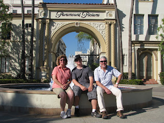
The next day we rented a car and drove to La Brea Tar Pits (between Beverly Hills and Hollywood). It was the first really hot day of the trip with the thermometer hitting 100 degrees by noon. Luckily, most of the fossil exhibits were inside the air conditioned Page Museum. However, the walk outside to see the remaining tar pits and then back to the car was really hot. Our next stop was Paramount Studios where Cindy had reserved tickets for a tour to see how pictures are made. The studio is made up of dozens of warehouse looking buildings that house the sets where movies and television shows are filmed. We walked through Dr. Phil’s set, as well as a few other sound stages for T.V. shows that none of us watched. The most impressive part of the tour was the outside street scenes that depict different neighborhoods in Manhattan: Soho, Washington Square, and the Upper East Side. We didn't see any actors but it was fun to see where they work. Later, we went to see Grumman’s Chinese Theater with its famous concrete slabs signed by the stars complete with hand and foot prints. We walked along the trail of the stars and read many of the star's plaques that are set in the concrete sidewalks along Hollywood Blvd. It’s amazing how many adult costume shops there are along Hollywood Blvd, I guess when the lights are turned out everyone in California is an actor (smile). It was still really hot and we must have drunk a gallon of water that day. We finished off the day at Hard Rock Cafe for dinner. We were happy to get back to the boat where temperatures were not as stifling.


Alex talked us into staying one more night so he could meet up with Sam again. We didn't mind staying since we hadn't yet seen the cruise ship, Queen Mary which had been permanently moored across the harbor and was turned into a museum and hotel. Our tour of the ship started with ghosts of Queen Mary tour in celebration of Halloween. We learned about all of the restless souls still haunting the ship, and had a laugh or two at their expense. The ship is enormous and we must have walked miles before we had seen enough that we were ready to leave. Alex took a cab to Sam's that evening, as I had already returned the rental car.

At this point we were eager to get to San Diego, so we cast off the dock lines once again and headed down the coast. San Diego is about 100 nautical miles southeast of Long Beach, so we decided to make the journey in two days. Oceanside Harbor is a bit more than half way to San Diego and about the only place to stop along the way. Much of the coast is off limits due to the military reservations that stretch out between LA and San Diego. As it turned out, Oceanside Harbor was a delightful stop. You enter the harbor by going around a jetty that parallels the shore protecting the real entrance that is flanked by two jetties. Ocean swells build into large surf just beyond the jetties. As you motor into the harbor, you can see surfers not very far away riding the big waves in. On the day we sailed into the harbor the surf was exciting to watch but we were in no danger. The public dock was easy to find and really very nice. Restaurants were a short walk away, and while we were walking to one a couple stopped us to ask if we were joining the Baja Ha-Ha. When we told them we were and that we had sailed from Seattle, they invited us to dine with them at their Yacht Club. We thanked them but declined. We had dinner in a little pub that was playing old rock-n-roll music. Cindy and Alex really enjoyed the tunes and stayed to hear the band warm up after dinner.  Our thoughts turned to the San Diego and the preparations that we needed to make to be ready for the sail down the Baja.      


It would have been fun to stay at Catalina Island longer but we all wanted time to see Los Angeles before heading to San Diego. We also promised Alex we'd be in Long Beach for his birthday. He wanted to go to Long Beach to see his friend, Sam, from soccer that moved to Long Beach from Woodinville. Our plan was to take Alex to dinner for his birthday, Sam would be his guest. Later, the boys could hang out around the waterfront for a few hours. It’s been more than a month since Alex had any companions his own age, so he was really eager to see Sam. We took the boys to Bubba Gump’s Restaurant and they both seemed to enjoy the Forest Gump decorations and the questions the waiter fired at us about the movie. Between Sam and Alex they got all but one question correct. We gave Alex a cell phone for an early birthday present before the trip, so he wasn't expecting any presents on his birthday, but Cindy surprised him with birthday cards and gifts from his grandparents. The surprise made Alex a very happy boy.

We left Catalina Island after a stay of only two nights. It was a 20 mile run across Catalina Channel to Long Beach and there were many boats around to keep us company. As we approached the middle of the channel the fog set in so thick you couldn't see more than 500 feet. Thanks again to our new Garmin RADAR we weren't the least bit nervous about travelling in the fog, despite the fact that Long Beach is the busiest harbor on the west coast. The breakwater that encircles the harbor is many miles long but we found the opening closest to Shoreline Marina with no difficulty even though the fog persisted.

Tuesday, October 18, 2011

From Oxnard we sailed to Two Harbors, Catalina Island, October 9th 2011

On Sunday, October 9th we left Channel Islands Marina (Oxnard) early in the morning and cruised south to Catalina Island about 60 nautical miles distant. Winds were light so we motored most of the way. We passed one large COSCO freighter, a large sailboat and many fishing boats along the way, and more offshore oil platforms. Porpoise frequently appeared a long side of the boat or ahead of the bow. They seem to enjoy surprising us by suddenly jumping up out of the water just a few feet from the cockpit.

Catalina Island is the most accessible island in the Channel Islands group. Most of the island’s roads and trails are open to the public, and three large harbors provide moorage for a thousand boats. We stayed at Two Harbors which is a large bay on the north side of the island facing the mainland. Across a short isthmus from Two Harbors is a bay on the north side of the island called Catalina Harbor. We walked the ½ mile dirt road to Catalina Harbor to see what it looked like.  At the east end of Catalina Island is the town of Avalon with its bay and very fashionable and expensive harbor facilities. In the guide books, Avalon looks more like it belongs on the French Riviera than the Californian coast. We didn’t visit Avalon.

Mooring at Catalina Island is different than anywhere we stayed so far. They make the best use of space in the harbors by using a two anchor mooring system where boats are tied-in bow and stern. This allows many more boats to be moored closely together, so they can better serve the large number of recreational boaters in southern California. Lucky for us this is not the peak boating season for Catalina Island and we found the harbors almost empty. When we approached our mooring buoy and picked up the tag line, the harbor patrol guy said it looked like we had done this before. We told him it was our first attempt. He then asked, “what kind of boat is that”? I told him it was a Pacific Seacraft and he said, “Oh, one of those old classic boats”. “Old I said?” “She’s not old, why she’s in her prime” She’s weatherly and fast, very fast if properly handled”.  Thanks to the movie Master Commander I have a lot of dialogue for this kind of an off handed remark.


After we settled in, we enjoyed hiking along the trails around the harbor and see views of the harbor below surrounded by tropical palm trees. It really is beginning to feel like the tropics. However, the temperature remains on the cool side and at night it still gets cold enough for sweaters and jackets.  

Ventura and Oxnard, October 7th 2011

We finally left Santa Barbara on Friday, October 7th bound for Ventura Harbor. It was a short 4-hour cruise with light winds. We motored most of the way and had an escort of large gray bottle nose dolphin part of the way. The water was so clear we could see the dolphin clearly 10-feet below the surface. Ventura Harbor was very big and modern and supported both commercial and recreational boats, but it didn't have the character as Santa Barbara.  The marina was next to the Channel Islands National Park Headquarters, so we walked over for a look at their displays of the Channel Islands. We read about the wildlife on the islands and the efforts being made to restore the islands to their pre-development condition. Some of the more populated islands like Catalina and San Clemente probably have less ambitious goals of restoration.
We stayed one night in Ventura then headed out again, this time bound for Catalina Island. We soon realized, however, that we'd never make port before nightfall, so we made an unscheduled stop at the Channel Islands Marina in Oxnard for the night.  The marina was only a few years old which is probably the reason it lacked many amenities that cruisers often need like a food market, liquor store and marine supply stores. This was the only stop we made where we didn’t take any photographs.


Touring Santa Barbara after Cindy joins the boat, October 4th 2011

After enduring many hardships and dangers (not really) the fearless crew of S/V Cool Breez’n finally reached the exotic shores of La-La Land (Southern California) where many distractions now compete for our time and attention: time seem to fall through our fingers like sand through a sieve. I imagine our friends and family who have been enjoying our blog must be wondering, what's happened to the fearless crew? Well I’m happy to report that we’ve just been having so much fun sight-seeing that we haven’t taken the time to update our blog. Sorry!
A forecast of heavy winds and rain kept us from venturing beyond the harbor for several days, after Cindy joined the boat in Santa Barbara. So we spent the days walking around town, visiting the Mariner’s Museum and old Spanish historical sites like the Presidio, De La Guerra’s family house, Santa Barbara’s Museum of History and the Zoo. Alex did some fishing too and cooked a fish dinner one evening.
A large part of the Mariner’s Museum is devoted to commercial diving which is not surprising since offshore oil development and commercial diving are so interdependent. If I grew up here I’m sure I would have been a commercial diver.
For those of you who are not Dana fans, Jose De La Guerra was a wealthy officer in the garrison at Santa Barbara when Richard Dana visited the area in the 1830’s. He invited Dana to his home for many evenings of food, drink and conversation, which gave Dana an opportunity to meet and talk with other educated guests. (Richard Dana wrote Two Years Before the Mast).  It was cool seeing the old Spanish mission and garrison that stood here when Richard Dana traveled to California but it is difficult to comprehend the changes that have taken place in a few short centuries that have since passed. Santa Barbara’s architecture still reflects its Spanish heritage. Tile roofs, stucco walls, arched doorways, verandas accented with colorful flowers. The tall shade trees that line Santa Barbara’s main street keep the temperature very comfortable during mid-day. 


Thursday, October 6, 2011

Oct 1 - Sail from Prisoner’s Harbor, Santa Cruz Island to Santa Barbara.

We spent one night anchored in Prisoners Harbor. The boat pitched and yawed in the swells all night making our sleep less than restful.  I noticed that one boat had arrived after us and dropped its hook close to the shore on the west side of the harbor. It found protection in the lee of the cliffs on shore, no swells interrupted the sleep of its crew that night. The skipper must have anchored here before and learned where to tuck in out of reach of the swells.
We weighed anchor at 9:15AM and headed north across the Santa Barbara channel. Our destination was Santa Barbara harbor in the city of the same name. Our course took us 22 miles north across the Santa Barbara channel. We sailed on a beam reach with west winds blowing at 18-20 knots most of the way. It was a lively sail. It took 5 hours to cross the channel and we got a closer look at the offshore oil platforms that stand like sentinels protecting Santa Barbara Harbor. 


Our first stop in the harbor was the fuel dock, where we took on 26 gallon of diesel. Next stop was the harbor office where we got our slip assignment and finally we docked Cool Breez’n for a well-deserved rest. Since none of the crew had ever been to Santa Barbara we were all anxious to get cleaned up and see what the town had to offer. We explored the shops and lobby of the Maritime Museum (it was already closed) in the inner harbor, and walked along the bike path past the beach, volley ball courts and boat ramps. We discovered one boat that had capsized earlier at the ramp and was a total loss but never learned how the accident happened. Then we walked out to the end of the fishing pier. Santa Barbara’s fishing pier is the oldest in the state it has several restaurants, souvenir, taffy and wine tasting shops, and a small aquarium. We were surprised to see that there are no railings at the end of the pier. When I asked about this obvious safety hazard I was told that it was in keeping with the historical character of the pier. I couldn’t but wonder who would own their historic pier after of the many lawyers in town sued the state when someone falls off the pier and drowns.

Santa Barbara is where we change crew once again. Bill will be leaving the boat tomorrow and Cindy will be joining us in a few days. We made the most of our last night with Bill by enjoying a fine sea food dinner onshore (which Bill treated us to, thanks again Bill) and talking about the experiences we shared together. Bill was a great addition to our crew. He quickly made friends with Alex by playing chess with him, asking him about music he listened to and about his experience sailing offshore. When it was time for Bill to leave we were both sorry to say good bye.

Now my thoughts turned to Cindy’s arrival in two days, we had much to do. The boat had been home to four males for almost a month. You might imagine that we had some domestic chores to do before she arrived and you’d be correct.. We cleaned the boat inside and out, knowing that it would not completely pass muster when she arrived but knowing that we had to give it our best attempt. Buckets, soap, wash brushes and the hose were employed with lust to the outside of the boat. Then sleeping bags, pillows and blankets where arranged on deck to air out. Next dirty laundry was gathered and hidden from sight, later there would be time to wash it. Counters were wiped clean, floors were swept and the stove got special attention. We no sooner finished our labors, showered and changed into clean, tropical tourist threads when my cell phone announced that Cindy had arrived by taxi.  It was time for a warm reunion, and celebration to mark the beginning of our cruise together as a family.

Wednesday, October 5, 2011

Sept 29-30- Overnight Sail from Morro Bay to Prisoner’s Harbor, Santa Cruz Island and Rounding Point Conception.


Departure from Morro Bay
We waited for the fog to lift hence our tardy departure at 11:00AM. As we motored out towards the entrance we could see Morro Rock and the PG&E Power Plant stacks, both hidden by fog when we arrived.  Also, the boats anchored in the channel are visible now and  we see more sailboats flying the green Baja Ha-Ha pennant. We’re starting to introduce ourselves to the sailors that we see flying the pennant. Soon 168 sailboats will gather in San Diego for the run south to Cabo San Lucas. We’re getting very exciting!


Point Conception and the Painted Cave
On this leg we passed Point Conception, the last challenging section of coast before entering calmer waters of Southern California. Point Conception is 60 nautical miles south of Morro Bay we motored around it at 9:00PM, it was nearly dead calm. The wind gods must be sleeping. Many guide books call Point Conception the “Cape Horn of the North Pacific” others that have sailed this stretch of water and have been becalmed like us sarcastically call it the Cape Horn of “Southern California”.  We believe that once we pass Point Conception we will no longer have stormy seas to contend with. It would be good if that were true. That’s why we chose a point south of Point Conception for Cindy to join the cruise.
We motored almost this entire leg from Morro Bay to Santa Cruz Island. Just as soon as we passed Point Conception we started seeing offshore oil platforms in the distance. At night you can see them 15 miles away, lit up like Christmas trees. A blazing torch that burns waste oil adds to the light we see coming from the platforms. Periodically, the torch burns so bright that it lights up the water all around the platform. First we see one platform, then a few more until we reach Santa Cruz Island and see six or seven platforms stretching out across the channel near Santa Barbara.
The logbook shows that we arrived at the west end of Santa Cruz Island, at 8:30 AM on Sept 30th. Santa Cruz Island is one of a group of channel islands south of Santa Barbara, other members of the group include: San Miguel, Santa Rosa and Anacapa Islands. The largest sea cave in North America is a few miles to the east on Santa Cruz Island, it’s called “Painted Cave” on our nautical chart. The entrance is over 80 feet high and is hundreds of feet deep, but there’s no place nearby to anchor. We stopped for a few minutes, took a few pictures of the entrance and continued to our anchorage.

We planned to anchor for the night at Pelican Bay but after motoring around the bay to look for a suitable spot to drop our hook we decided to find a better anchorage.  Pelican Bay was deeper than we liked and many boats were already anchored there. The skipper of a motor boat anchored in the middle of the bay told us he was using his backup ground tackle and that he let out a lot of rode, meaning his boat would swing over a large area.  We didn’t want to be anchored anywhere near that boat so we motored on. 

The next bay to the east, Prisoners Harbor, looked just perfect for us. The water is 15-20 feet deep throughout most of the anchorage and the bottom is gradually sloping sand, so it’s not likely we would drag our anchor.  A large dock is situated in the middle of the bay and no other boats were at anchor in the bay.  We dropped our hook at 10:50AM.  Bill and I inflated the dinghy and rowed to shore to stretch our legs, while Alex caught up on his sleep from his night watch.
Once on shore we discovered that part of the island was accessible to visitors but other parts were not. East of Prisoners Harbor is a National Park and visitors are allowed to hike and camp overnight. West of the harbor the land is owned by the Nature Conservancy and visitors are not allowed. A gate just a few hundred feet into the island blocks off access to the restricted part of the island.  I told Bill that this island would make a good Jurassic Park, he agreed. We followed a short trail up to a lookout point and took a few pictures of the dock and our boat, then hike back down. On the way back we spotted a fox, sneaking around the picnic tables. Later, when Alex took the dinghy to shore to fish he saw three foxes and scores of Humboldt Squid stranded along the shore. Later, we learned that the commercial fishermen go to the Channel Islands from Santa Barbara to fish for lobster, crabs, and halibut. Commercial squid boats with their bright lights can be seen at night, closer to the mainland coast fishing for squid.


Monday, October 3, 2011

Sept 27 - 29 Overnight Sail from Monterey Bay to Morro Bay

Departed Monterey Bay fuel dock at 9:00AM and headed for Morro Bay (120 nm).

Westerly winds 15 knots at 10:30AM, increasing to 22 knots by 1:35 PM. We sailed at 6 knots or more on a beam reach with reduced sails. By 11:00PM the wind had died down and we started the engine. Alex made the crew a hearty soup. He combined a vegetable and pasta soup mix with spicy Italian sausage, it didn't last long and there were no complaints from the crew. Later, Alex baked chocolate chip cookies for desert. The sugar must have energized Alex because he offered to take my 12-3:00AM watch and worked on his algebra homework while he kept watch.

Our B&G auto pilot began to spontaneously switch to standby mode after a few hours of working.  This caused the crew to resort to manual steering during each watch. After shutting off the autopilot for an hours or two it usually works fine for an hour or two, then it switches itself to standby mode again and the crew is obliged to steer by hand again. This caused Alex much frustration while he was trying to do his homework and keep watch in the wee hours of the morning.

Fuel consumption is something that we’ve been calculating every time the fuel tank is filled. We carry 45-50 gallons of fuel in the fuel tank, plus 30 gallons in six jerry cans lashed to the stanchions:  75 gallons in all. So far the longest leg of our cruise has been from Grays Harbor, Washington to San Francisco, CA, approximately 750 nautical miles.  By the time we arrived at San Francisco we had about 25 gals of fuel remaining. We motored through calms at the beginning and end of that leg, and motored again during the storm after our staysail hanks failed.

As best we can calculate we are getting between 0.87 and 0.75 gals per hour, or 7 to 8 nautical miles per gallon at 6 knots.  Our 75 gallon fuel supply will take us about 500 – 600 nautical miles, however, not wanting to drain the tank dry a practical range of 450 miles.

We arrived at the sea buoy at the entrance of Morro Bay at 8:00 AM, visibility was limited to about 100 yards due to the fog. I steered the boat to the south side of the entrance and turned north at the 30-foot contour to find the red buoy that marked the entrance.  After calling a “securitay” on channel 16 we proceeded into the outer harbor. The fog made navigation from buoy to buoy not possible and a strong flood current cause me to head back out until current slackened and visibility improved. I called a second “securitay” to inform other boats that we were standing off at the sea buoy until conditions improved.  The swells were already 6-8 feet high as we headed back out. Morro Bay Harbor Patrol responded right away, saying, “if you’d like we’ll meet you at the sea buoy in 5 minutes to escort you in, the flood tide is late but it’s nearly over and you’d be better off coming in now than after the start of ebb tide”. I accepted their offer and thanked them. In a few minutes we could see a blue patrol boat coming our way. They asked us where we were planning on mooring, I said “we’re headed for the Morro Bay Yacht Club”, and the patrol boat led us right to their front door.


Bill commented that Morro Bay looks more like the Swanomish Slew near La Conner, Washington than any place in California. I agreed saying that if you had just materialized here without knowing where you were you'd never guess that you were in California.

I asked the harbormaster at the yacht club when the fog will lift: yesterday was his answer. We rafted up to one boat at the dock, but moved to another spot at the end of the dock that had just opened up. While the crew took a well-earned nap, a sail boat operated by a young fellow rafted up to us. He offered a six-pack for the inconvenience of his arrival but I declined, saying it was not necessary.  The skipper Brennan and his crew of two young ladies are headed south. Of the three other sailboats at the dock, two were participating in the Baja Ha Ha.  We’ve been seeing more boats with the familiar green pennant the farther south we get. Though, Brennan and crew are not joining the Ha-Ha, I’m sure will bump into them again, somewhere down the line.


Morro Bay provides more than a safe harbor for sailors cruising the west coast, its rural character provides a place where you can rest and enjoy the first silence in many days. Here the wind doesn't blow the halyards into a rat-a-tat against your mast, sea lions don't wake you with their constant barking, music doesn't blare from your neighbor's boat, and you barely hear a car or truck go by. The quiet is something you'll notice right away, and its delightful.